

RealEarth

وصف لـRealEarth
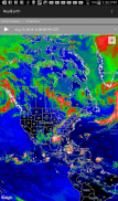
The RealEarth app provides access to real-time imagery and data products hosted by the University of Wisconsin - Madison Space Science and Engineering Center (SSEC). These products include global and regional remotely sensed atmospheric, terrestrial, and oceanographic imagery, observations of local meteorological parameters, and short-range predictions of future conditions. Features include:
- Select products to display by category, name, and time
- Pan and zoom map interface dynamically
- Display current location on map
- Animate by relative or absolute time steps
- Save custom favorites
Future enhancements will include capabilities for users to create custom geographic areas that will denote notification regions. Events such as severe weather, floods and fires will trigger a notification message directly to the user's mobile device.
ويوفر التطبيق RealEarth الوصول إلى الصور والبيانات المنتجات في الوقت الحقيقي الذي استضافته جامعة ويسكونسن - ماديسون مركز علوم الفضاء والهندسة (SSEC). وتشمل هذه المنتجات العالمية والإقليمية الاستشعار عن بعد في الغلاف الجوي، الأرضية، والتصوير المحيطات، ملاحظات المعلمات الأرصاد الجوية المحلية، والتوقعات قصيرة المدى من الظروف المستقبلية. السمات ما يلي:
- اختر المنتجات لعرضها حسب الفئة، اسم، والوقت
- والتكبير واجهة خريطة حيوي
- عرض الموقع الحالي على الخريطة
- تنشيط عن طريق الخطوات الزمنية النسبية أو المطلقة
- حفظ العرف المفضلة
وسوف تشمل التحسينات المستقبلية القدرات للمستخدمين لإنشاء المناطق الجغرافية المخصصة التي من شأنها أن تدل على المناطق الإخطار. سوف أحداث مثل الطقس الشديدة والفيضانات والحرائق يؤدي رسالة إعلام مباشرة إلى الجهاز المحمول الخاص بالمستخدم.


